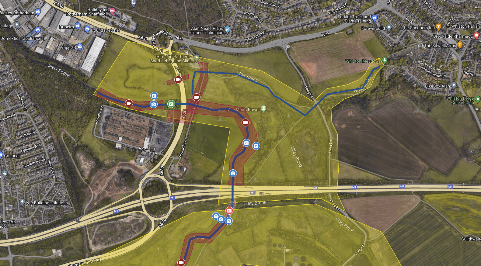
Interactive Maps incorporating 3D Virtual Tours, 360 Pano Images, Drone Images, Hi-Res Photography and Lidar Surveys created by Apollo3D for the Environment Agency.

3D Tours

Ground level self-guided exploration of the area, with high quality 360 photography.

Fly-Ins

Capturing aerial content for all areas, including; rivers, caves, buildings, flood defences.

Interactive Map

An engaging site map, allowing you to virtually explore online.

Environment Agency Locations
  1. Wheel Hall Slip

    Wheel Hall Farm, York YO19 6RA

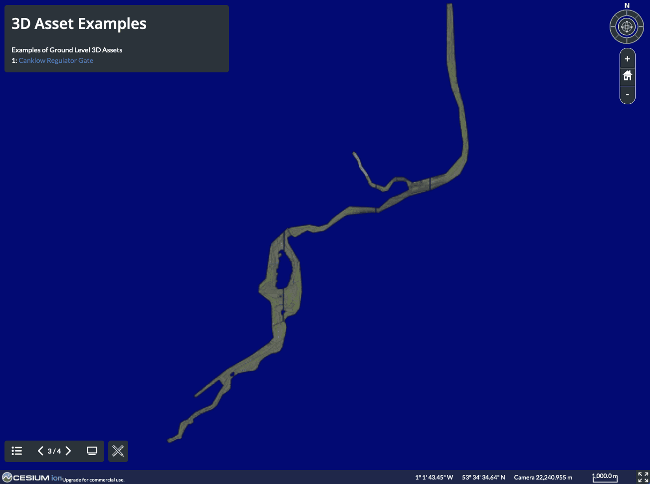
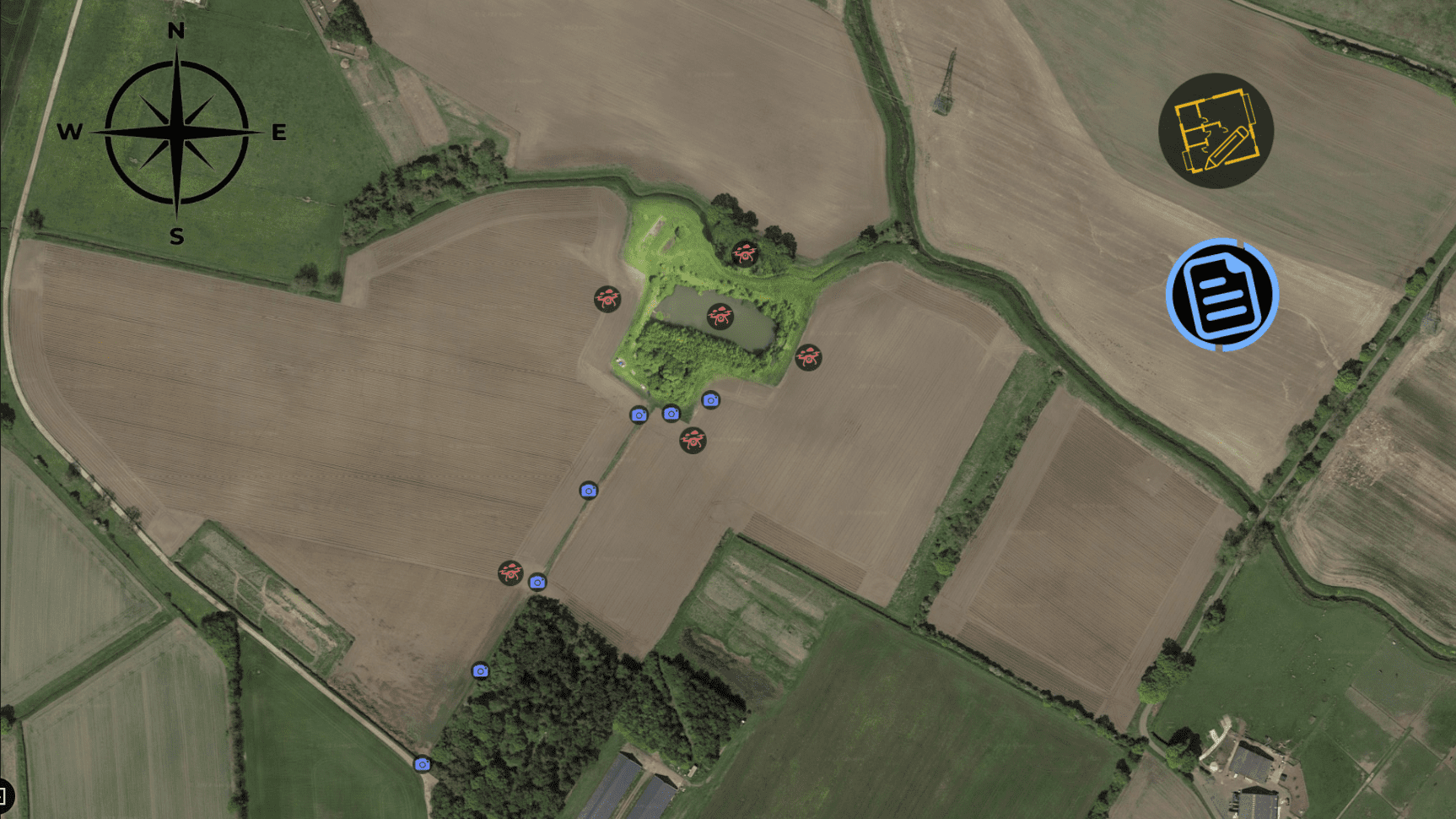
    Wheel Hall Slip is located next to the river Ouse and has been subject to eroding embankments, potentially damaging land and properties nearby. On this location, we have created a 3D model and captured geomatic data covering the worst areas of erosion. We’ve also captured ground & aerial 360s covering the rest of the site to cover all angles. Also included are 4K videos of the embankment both upstream and downstream.
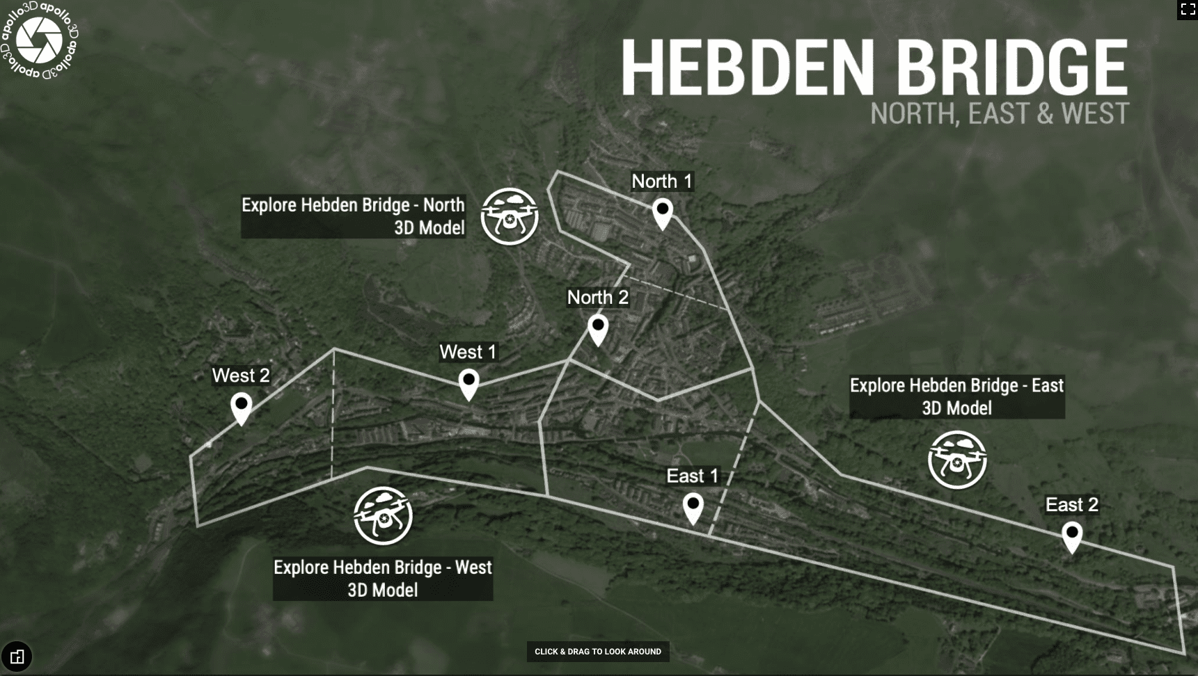
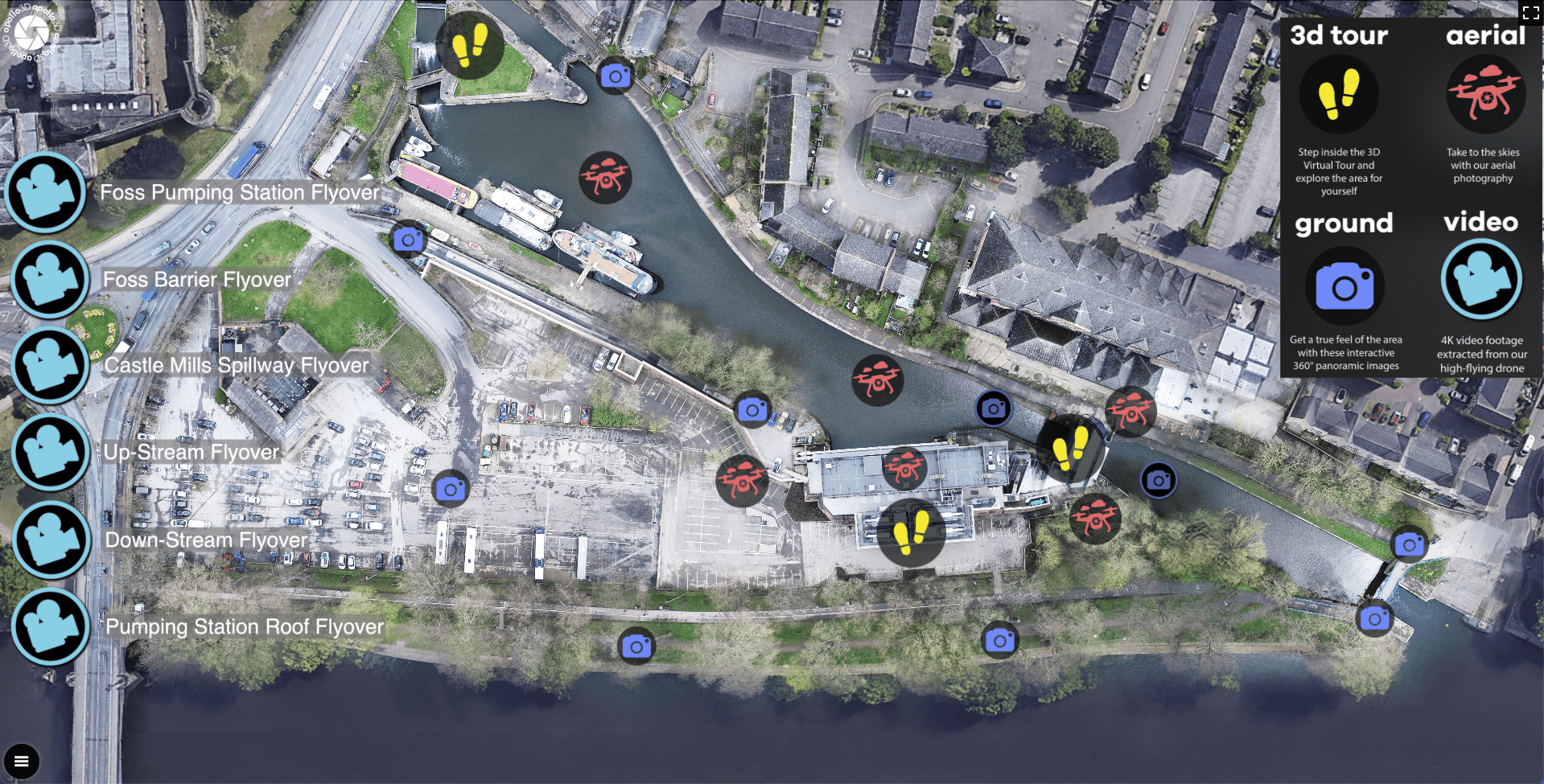
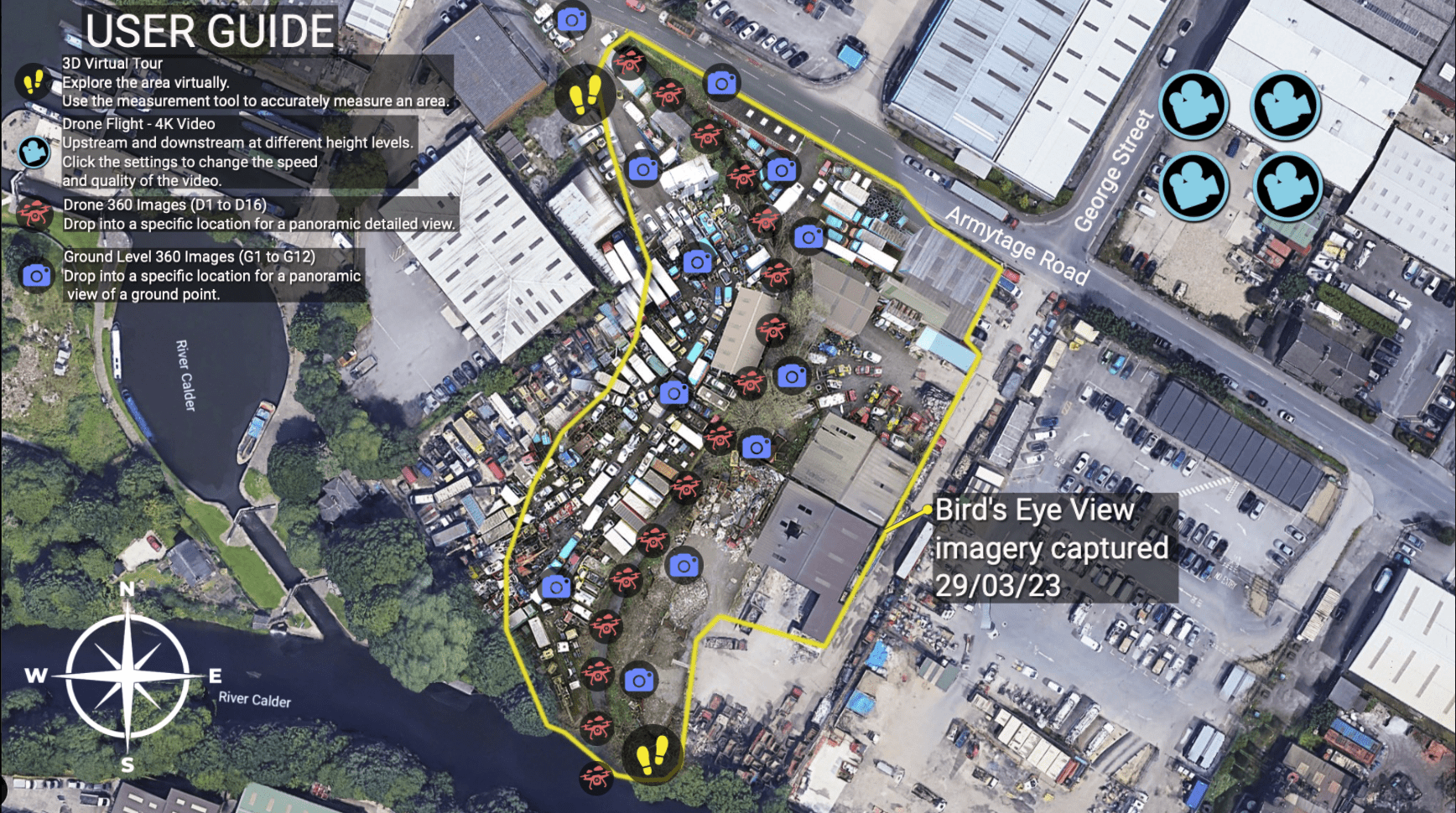
    Map View
    Wheel Hall Slip
  2. hebden bridge

    37 W End, Hebden Bridge HX7 8UQ

    Hebden Bridge is located around the river Calder. We mapped this area to help contactors plan for works to be done in and around Hebden Bridge. On this location we created 3D models around Hebden Bridge to get an updated detailed view of each area. We also created drone video of the confluence wall and river.

    Map View
  3. Foss Barrier

    Tower St, York YO10 4FD

    The York Foss barrier is located between the River Ouse & the River Foss. On this location, we have created 3D models covering the Foss barrier, the Foss pump house, and the Castle Mills spillway. We have also captured multiple ground and aerial 360s covering the larger site. Also, aerial video footage is covering the Foss barrier, the Foss pump house roof and the Castle Mills spillway and an upstream and downstream flyover.

    Map View
    Foss Barrier
  4. Woodhouse Mill & Meadowgate

    River Rother, Brinsworth, Rotherham

    Woodhouse Mill & Meadow Gate is located around the river Rother and the Meadow Gate lake area. We mapped this area to show the infrastructure around the river at three different locations. On this location we have captured multiple 360 & 2D images of each site along the river. Included are 360 videos along the river and at key access locations.

    Map View
  5. Todmorden

    Shade School, Knollwood Rd, Todmorden OL14 7PD

    Back Waterloo river runs through the centre of Todmorden and under Shade Primary school. We mapped this area showing the infrastructure around this strip of river and updated imagery for contractors to view. On this location we created three 3D models covering the inside of the river, 360s are dotted around the river and along the road. Also, under Shade Primary School we recorded a drone flight upstream and downstream of difficult to access areas.

    Map View
  6. Tadcaster

    Tadcaster LS24 8AB

    The River Wharfe has majorly flooded the centre of Tadcaster over the previous years causing damage to the A659 bridge and surrounding embankments. On this location we have created multiple 3D models covering specific aeras of the embankment that have been impacted the most. We’ve also captured ground & aerial 360s of the surrounding area with a upstream and downstream flyover.

    Map View
  7. Keighley and Stockbridge

    Keighley BD21 4HP

    Keighley and Stockbridge are located around the river Aire and the river Worth. We mapped this area to show the condition of the infrastructure around these rivers. On this location we created 3D models at specific areas along the river and the rest of the river is covered with individual 360 images. Drone 360s are also positioned along the river and at higher altitudes to give a better perspective. Drone video flyovers also cover specific areas of the river upstream and downstream.

    Map View
  8. Brighouse

    Mill Ln, Brighouse HD6 1PN

    Brighouse FAS beck section, leads into River Calder, has been flooding and eroding the embankment putting surrounding business at risk. On this location we created a 3D model covering the whole beck section. We also captured ground & aerial 360s of the surrounding area and upstream and downstream flyovers.

    Map View
  9. Doncaster

    Thorpe Bank, Barnby Dun, Doncaster DN3 1ET

    The river Don & the river Dun Navigation are located on the outskirts of Doncaster around Kirk Bramwith. This area was prone to extreme flooding. On this location we created a high-definition point cloud data map of the area so contactors can gather accurate measurements of the embankments around each river.

    Map View
  10. Bridge Farm

    Strensall, York YO32 5TT

    Bridge farm is located just north of Strensall. There has been lots of flooding around the farm, therefore we’ve captured lots of imagery and data to help find a solution. On this location we’ve captured multiple ground and aerial 360s for the viewer to explore the area. We also captured photogrammetry data and cross section files.

    Map View